> ## Documentation Index
> Fetch the complete documentation index at: https://docs.altnautica.com/llms.txt
> Use this file to discover all available pages before exploring further.
# Pattern Generators
> Automated flight patterns for survey, orbit, corridor, SAR, structure scan, and landings.
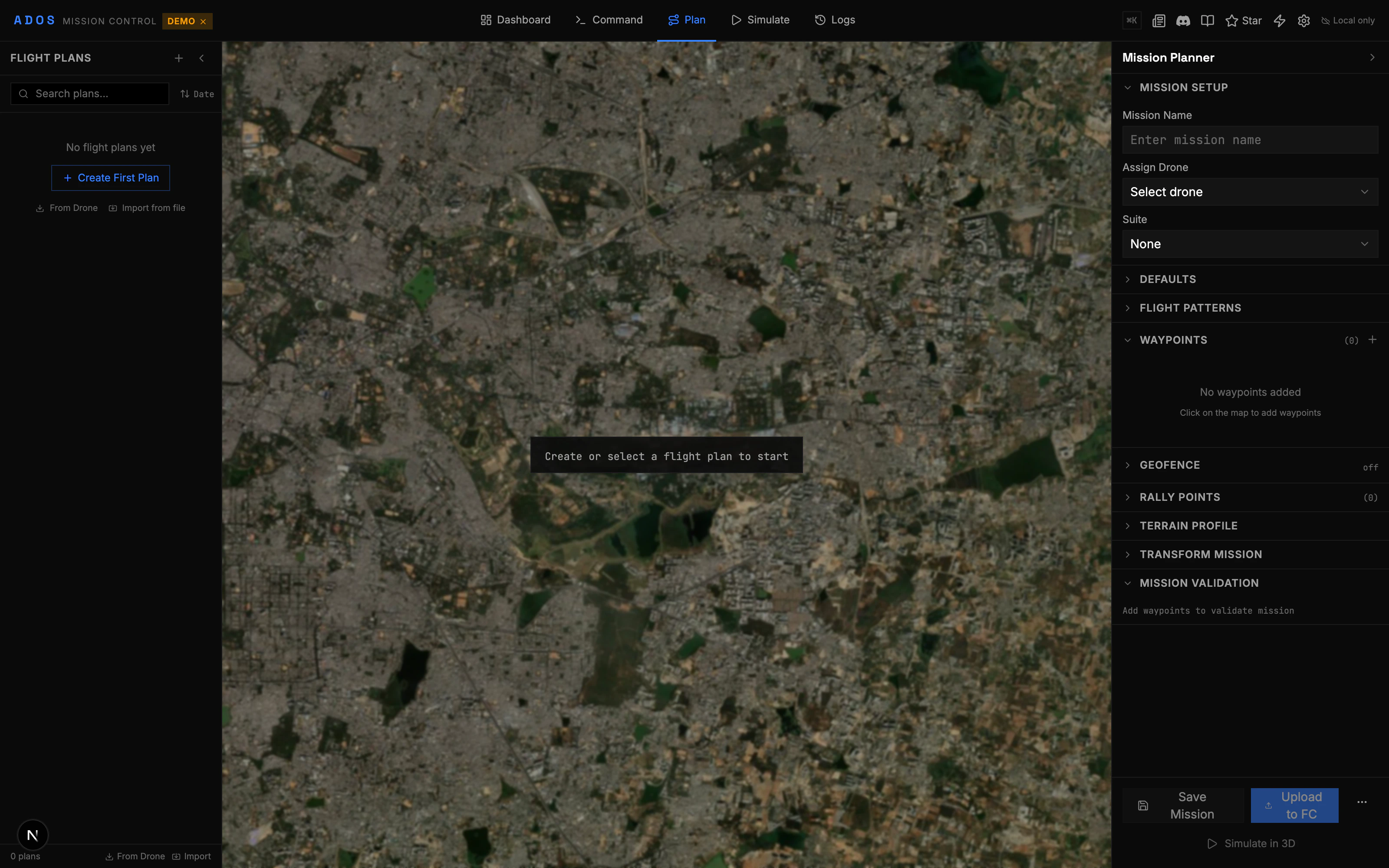
Pattern generators create waypoint sequences automatically from a boundary polygon and configuration parameters. Draw a shape on the map, pick a pattern type, adjust the settings, and apply the generated waypoints to your mission.
 ## How It Works
Use the polygon or circle tool from the map toolbar to draw the area you want to cover.
With the boundary selected, click "Generate Pattern" in the toolbar. The Pattern Editor panel opens on the right.
Select from the available patterns: Survey, Orbit, Corridor, Structure Scan, Expanding Square, Sector Search, or Parallel Track.
Each pattern has specific settings (spacing, altitude, overlap, angle, etc.). Adjust them and see the preview update on the map in real time.
Click "Apply" to add the generated waypoints to your mission. The pattern becomes part of your waypoint list.
## Available Patterns
### Survey
Generates parallel flight lines (lawn-mower pattern) to cover an area. This is the standard pattern for photogrammetry, mapping, and crop monitoring.
**Configuration:**
| Parameter | Description |
| ------------- | ------------------------------------------------- |
| Line spacing | Distance between parallel lines (meters) |
| Altitude | Flight altitude (meters AGL) |
| Angle | Direction of the survey lines (degrees) |
| Overshoot | Extra distance past the boundary before turning |
| Front overlap | Percentage of image overlap along the flight line |
| Side overlap | Percentage of overlap between adjacent lines |
| Camera | Select a camera profile for GSD calculation |
The GSD calculator automatically computes Ground Sample Distance based on your camera, altitude, and overlap settings. See the GSD section below.
### Orbit
Generates a circular flight path around a center point. Use this for inspection, videography, or point-of-interest observation.
**Configuration:**
| Parameter | Description |
| ----------- | -------------------------------------- |
| Radius | Distance from center (meters) |
| Altitude | Flight altitude (meters AGL) |
| Points | Number of waypoints around the circle |
| Direction | Clockwise or counter-clockwise |
| Start angle | Where on the circle to begin (degrees) |
### Corridor
Generates a path that follows a corridor (road, pipeline, power line) with parallel lines on either side for coverage.
**Configuration:**
| Parameter | Description |
| --------- | ----------------------------------- |
| Width | Corridor width to cover (meters) |
| Altitude | Flight altitude (meters AGL) |
| Spacing | Distance between parallel passes |
| Overshoot | Extension beyond corridor endpoints |
### Structure Scan
Generates a multi-altitude orbit for scanning a vertical structure (building, tower, cliff). The drone circles at several altitudes to capture the entire surface.
**Configuration:**
| Parameter | Description |
| ---------------- | ------------------------------------ |
| Radius | Distance from the structure (meters) |
| Bottom altitude | Lowest orbit altitude |
| Top altitude | Highest orbit altitude |
| Layers | Number of vertical orbits |
| Points per layer | Waypoints per orbit |
| Camera angle | Gimbal pitch toward the structure |
### SAR Patterns
Three search-and-rescue patterns for covering an area systematically:
Starts at the center (last known position) and spirals outward in an expanding square. Best when the target's probable position is well known.
**Parameters:** Start point, leg length, spacing, altitude, expansion factor.
Divides the area into pie-slice sectors searched one at a time. Good for coastal or river bank searches.
**Parameters:** Center point, radius, number of sectors, altitude, sweep angle.
Covers a rectangular area with parallel lines, similar to survey but optimized for visual search. Lines are closer together for thorough coverage.
**Parameters:** Area boundary, track spacing, altitude, search direction.
### Landing Generators
Two specialized patterns for approach and landing:
* **Fixed-Wing Landing:** Generates a landing approach with configurable glide slope, final approach altitude, and runway alignment.
* **VTOL Landing:** Generates a VTOL transition and descent pattern with configurable transition altitude and descent point.
## GSD Calculator
The Ground Sample Distance (GSD) calculator helps you determine the right altitude and line spacing for photogrammetry missions.
**Inputs:**
* Camera sensor dimensions (width and height in mm)
* Focal length (mm)
* Image resolution (width and height in pixels)
* Flight altitude (meters AGL)
**Outputs:**
* GSD (cm/pixel)
* Image footprint on the ground (width and height in meters)
* Required line spacing for desired overlap
* Estimated photo count for the survey area
Several camera profiles are built in (common drone cameras), or you can enter custom sensor specs.
## Pattern Preview
As you adjust parameters, the map shows a live preview of the generated pattern:
* Waypoints are displayed as numbered markers
* Flight lines connect the waypoints
* The boundary polygon remains visible
* Statistics (total distance, number of waypoints, estimated time) update in real time
The preview is non-destructive. Nothing changes in your mission until you click "Apply."
## Pure Functions
All pattern generators are implemented as pure functions. They take a configuration object and return a list of waypoints with statistics. No side effects, no store access. This makes them easy to test and compose.
```
Input: { boundary, altitude, spacing, angle, ... }
Output: { waypoints: [...], stats: { distance, time, photos, ... } }
```
## How It Works
Use the polygon or circle tool from the map toolbar to draw the area you want to cover.
With the boundary selected, click "Generate Pattern" in the toolbar. The Pattern Editor panel opens on the right.
Select from the available patterns: Survey, Orbit, Corridor, Structure Scan, Expanding Square, Sector Search, or Parallel Track.
Each pattern has specific settings (spacing, altitude, overlap, angle, etc.). Adjust them and see the preview update on the map in real time.
Click "Apply" to add the generated waypoints to your mission. The pattern becomes part of your waypoint list.
## Available Patterns
### Survey
Generates parallel flight lines (lawn-mower pattern) to cover an area. This is the standard pattern for photogrammetry, mapping, and crop monitoring.
**Configuration:**
| Parameter | Description |
| ------------- | ------------------------------------------------- |
| Line spacing | Distance between parallel lines (meters) |
| Altitude | Flight altitude (meters AGL) |
| Angle | Direction of the survey lines (degrees) |
| Overshoot | Extra distance past the boundary before turning |
| Front overlap | Percentage of image overlap along the flight line |
| Side overlap | Percentage of overlap between adjacent lines |
| Camera | Select a camera profile for GSD calculation |
The GSD calculator automatically computes Ground Sample Distance based on your camera, altitude, and overlap settings. See the GSD section below.
### Orbit
Generates a circular flight path around a center point. Use this for inspection, videography, or point-of-interest observation.
**Configuration:**
| Parameter | Description |
| ----------- | -------------------------------------- |
| Radius | Distance from center (meters) |
| Altitude | Flight altitude (meters AGL) |
| Points | Number of waypoints around the circle |
| Direction | Clockwise or counter-clockwise |
| Start angle | Where on the circle to begin (degrees) |
### Corridor
Generates a path that follows a corridor (road, pipeline, power line) with parallel lines on either side for coverage.
**Configuration:**
| Parameter | Description |
| --------- | ----------------------------------- |
| Width | Corridor width to cover (meters) |
| Altitude | Flight altitude (meters AGL) |
| Spacing | Distance between parallel passes |
| Overshoot | Extension beyond corridor endpoints |
### Structure Scan
Generates a multi-altitude orbit for scanning a vertical structure (building, tower, cliff). The drone circles at several altitudes to capture the entire surface.
**Configuration:**
| Parameter | Description |
| ---------------- | ------------------------------------ |
| Radius | Distance from the structure (meters) |
| Bottom altitude | Lowest orbit altitude |
| Top altitude | Highest orbit altitude |
| Layers | Number of vertical orbits |
| Points per layer | Waypoints per orbit |
| Camera angle | Gimbal pitch toward the structure |
### SAR Patterns
Three search-and-rescue patterns for covering an area systematically:
Starts at the center (last known position) and spirals outward in an expanding square. Best when the target's probable position is well known.
**Parameters:** Start point, leg length, spacing, altitude, expansion factor.
Divides the area into pie-slice sectors searched one at a time. Good for coastal or river bank searches.
**Parameters:** Center point, radius, number of sectors, altitude, sweep angle.
Covers a rectangular area with parallel lines, similar to survey but optimized for visual search. Lines are closer together for thorough coverage.
**Parameters:** Area boundary, track spacing, altitude, search direction.
### Landing Generators
Two specialized patterns for approach and landing:
* **Fixed-Wing Landing:** Generates a landing approach with configurable glide slope, final approach altitude, and runway alignment.
* **VTOL Landing:** Generates a VTOL transition and descent pattern with configurable transition altitude and descent point.
## GSD Calculator
The Ground Sample Distance (GSD) calculator helps you determine the right altitude and line spacing for photogrammetry missions.
**Inputs:**
* Camera sensor dimensions (width and height in mm)
* Focal length (mm)
* Image resolution (width and height in pixels)
* Flight altitude (meters AGL)
**Outputs:**
* GSD (cm/pixel)
* Image footprint on the ground (width and height in meters)
* Required line spacing for desired overlap
* Estimated photo count for the survey area
Several camera profiles are built in (common drone cameras), or you can enter custom sensor specs.
## Pattern Preview
As you adjust parameters, the map shows a live preview of the generated pattern:
* Waypoints are displayed as numbered markers
* Flight lines connect the waypoints
* The boundary polygon remains visible
* Statistics (total distance, number of waypoints, estimated time) update in real time
The preview is non-destructive. Nothing changes in your mission until you click "Apply."
## Pure Functions
All pattern generators are implemented as pure functions. They take a configuration object and return a list of waypoints with statistics. No side effects, no store access. This makes them easy to test and compose.
```
Input: { boundary, altitude, spacing, angle, ... }
Output: { waypoints: [...], stats: { distance, time, photos, ... } }
```